Microseismic monitoring of abandoned salt mines beneath Northwich
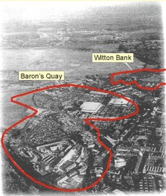 Northwich is underlain by abandoned salt workings. These workings were at risk of imminent collapse. As part of the English Partnerships Land Stabilisation project, Vale Royal Borough Council were awarded £28.9 million to remediate the problem.
It was the largest project of its kind in the world, with 850,000 m3 of void (equivalent to 320 Olympic sized swimming pools) to be filled at depths of 90m below ground, which released 32 hectares of land for regeneration.
As part of the project, the Applied & Environmental Geophysics Research Group were given funding to monitor microseismic activity around the workings for 5 years.
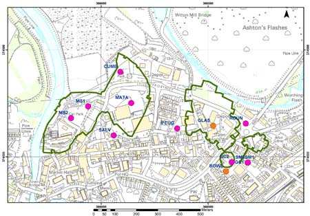
We ran a 10 station seismic network around the workings using borehole geophones at depths from 70m to 120m below ground level.
The data was acquired using ISSI seismometers at each site which telemeter the data back to a central site to be automatically processed. The data was then be sent back to Keele via the Internet for further processing. The map below shows the layout of the seismic network around the town centre.
Each station consisted of a 3 component geophone cemented in a borehole with an ISSI QS at the surface digitising the data. If the QS detected a seismic event it was logged to a hard disk drive. The stations were polled by the central station to determine the state of health of the system and to retrieve any events at the individual stations. The central station then associated the events from the stations to form common events and to automatically locate them. The data was then transmitted back to a processing workstation at Keele via a broadband internet connection.