Our services
Contact special.collections@keele.ac.uk
Important: If you’re expecting an email from us and haven’t received it, please check your Spam or Junk folder and add our address to your safe sender list.
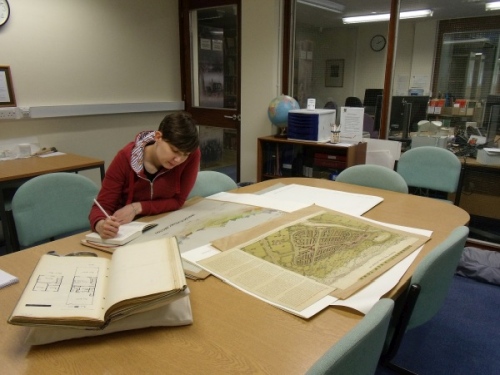
Archives Searchroom - Searchroom opening hours 9.15am to 4.45pm, Monday to Friday. By prior appointment only.
Appointment requests - At least one week’s notice is required.
Document requests - Items requested a week in advance may be consulted. Requests should be emailed to special.collections@keele.ac.uk.
Archives registration form - Please complete the Archives registration form.
Facilities - There is access to Library toilets, a refreshments area, and browsing of main Library stock.
Local Collection - Browsing of the shelves is permitted. Items may also be requested in advance. External visitors wishing to consult the Local Collection must make an advance appointment by contacting special.collections@keele.ac.uk.
Enquiries - An email enquiry service remains available, 9am to 5pm, Monday to Friday.
Accessing the Campus Library - Visitor parking is Pay to Park (£1.00 2 hours/£3.00 4 hours) on the Students’ Union (E2) carpark, just a short walk from the Library. Payment is by the JustPark App or by telephone. There is no cash payment facility and spaces cannot be pre-booked. To arrange a stay of more than 4 hours, please contact the Archives in advance at special.collections@keele.ac.uk.
Blue Badge parking is available in front of the building and there is a ground floor accessible entrance, otherwise access is via external steps to the second floor. On entering the building visitors are greeted and directed to the Archives by Library Welcome Desk staff.
We welcome enquiries and are happy to undertake a limited amount of research on your behalf, free of charge, without you having to visit in person.
Email: special.collections@keele.ac.uk
Tel: +44 (0)1782 733237
Write to:
Special Collections and Archives
Campus Library
Keele University
Staffordshire
ST5 5BG
We offer a comprehensive copying service. Copies can be ordered remotely, or as part of a visit to the Archives, and can be supplied by email, through the post or collected in person.
The purchase of imagery does not carry any rights to publish or reproduce. Before reproducing material in any way, please contact us. Reproduction and publication fees are available upon request.
Please note that a minimum charge of £10.00 applies to remote requests. Prices are inclusive of VAT and all customers must complete either:
a Copyright Declaration Form (Unpublished)
or a Copyright Declaration Form (Published).
Photocopying
We provide photocopies subject to the condition and dimensions of the original material, and subject to UK copyright legislation.
Published, non-archive material
- A4/A3 black and white - 50p
- A4/A3 colour - £1.00
Archive material
- A4/A3 black and white - £1.00
- A4/A3 colour - £1.50
Digital images
We carry out digital photography and scanning from a wide range of original materials. Large or difficult jobs will be quoted for separately. Our standard prices for copying from documents, supplied as a digital file by email, are:
- Price of first image - £3.00
- Price of successive images if from the same item - £1.50
- High resolution digital images from our photographic collections - £10.00 each
Photography
You may take your own flash-free photography from our manuscript collections, free of charge, but subject to the following conditions:
- The photography must not cause undue risk to documents
- Readers must complete either:
a Copyright Declaration Form (Unpublished) recording each document copied
or a Copyright Declaration Form (Published) recording each document copied
- Permission must be sought from copyright holders before reproducing images – please ask staff for advice
- A reproduction/publication fee will be charged in return for granting permission to reproduce or publish images belonging to the Archives